Using technology of the future to uncover the past
By Jorja Strickland, December 21 2022—
Archaeology — a field of study whose research is often not recognized to be as interesting as it really is. As the development of research methods continues, archaeology quickly becomes illuminated with the use of lasers, 3D mapping and DNA technology.
A professor at the University of Calgary in the department of archeology and anthropology, Dr. Kathryn Reese-Taylor, has been conducting groundbreaking research using light detection and ranging technology, better known as LiDAR. A form of laser scanning, her project uses aerial LiDAR, meaning that pulses were sent down from a sensor on a plane and when hitting something, they would bounce back to the sensor. The data that is gained is based on the measurement time it takes for the lasers to hit the sensor after being reflected. Archaeologists use this data to get a 3D map of the ground surface, which could reveal temples, buildings and other such features that have previously been unknown. The benefits of this technology are numerous, especially when considering the precision with which it reveals large expanses of area.
“It makes me feel excited all over again about the work that I get to do,” said Reece-Taylor about LiDAR, noting the value of this new technology. “I don’t feel like I’m just redoing something, I feel like I’ve got a fresh approach.”
Considering the use of LiDAR in archaeology, the best way to discuss such matters is by examining the project that Reese-Taylor herself is directing, one that goes back thousands of years, farther south, and into the civilization of the Maya, the city of Calakmul.
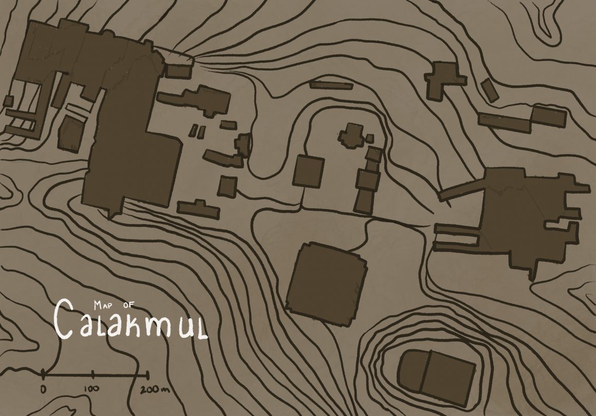
Having existed for 12 centuries, Calakmul is rich with structural ruins and incredible pieces of architecture from the Mexican past, such as temples and shrines. Due to LiDAR, Reese-Taylor and her team were able to gain much greater detail about the layout of the city, using the 3D mapping images to explore past what was already discovered from this site. Quite literally, pushing the boundaries.
“We always knew that Calakmul was more than just this 25 square kilometers, but now we know that it’s enormous,” said Reece-Taylor. “And probably for its time period, if not the, then one of the biggest cities in the Americas.”
Using the data gained from this technology, the team can investigate further into the urban planning of Calakmul, a specific area of interest being a household compound. Depending on excavation and further testing, this compound could potentially reveal a new form of social organization based on kinship, or even on an economic aspect like an occupation. As well, extensive land of this site was discovered, composed of roads, residences and much more that allow archaeologists to dig deeper into the history of this site, gaining depth in their comprehension of the Mayan society.
However, even with the large territory of the site that has been uncovered, they haven’t found its limits yet, so another step forward is to expand on the LiDAR survey, to get a better idea of the complete span of Calakmul. Further, the team is going to commence a regional testing program to establish the temporal data. LiDAR gives a great geographical landscape, but it lacks the chronology needed to give cultural context, so this program will be able to fill in the holes of data, thus establishing a solid base for researchers to work off of. Considering excavations and research, the focus at the moment is possible marketplaces, water storage areas, and agricultural areas — all of which give more of an indication of the society of Calakmul.
“We’re going to be doing some terrestrial LiDAR of some structures and some of the sculpture in Calakmul, in order to develop a baseline for heritage monitoring in the region,” said Reese-Taylor, when asked about future plans for this archaeological site.
The exposure of aerial LiDAR is only the beginning for this site, with a lot more research and exploration to come.
The impact that LiDAR, and other technology such as remote sensing, now has on archaeology is exponential. In showing the extent of sites, and the detailed features that span across the area, work can be done to maintain these cherished areas and conserve the landscape.
Further, the development of this research is “important to people living around this area,” said Reese-Taylor, taking on a significant perspective of her research. “These communities not only have an interest in preserving these remains of what their ancestors built, but also this is an important economic resource for them.”
Delving into the history of this incredible site, and expanding the knowledge that is already collected, helps local communities reconnect with their identity through their own heritage and personal ancestors.
“I think for all people in the Americas, it’s crucial to understand that history did not begin with settlers,” said Reece-Taylor, drawing forward an important concept of recognition. “There were vibrant cities and incredible innovations that were here prior to Europeans arriving.”
The revelations that LiDAR has brought forward in determining more about Calakmul is extremely valuable and relevant in today’s archaeology, yet Reece-Taylor and her team are only just starting in their research of this city and the knowledge and comprehension it has to offer.
